


At least 11 civilians were injured during consecutive airstrikes in Arakan State’s Thandwe Township on July 23-24 carried out by the Myanmar Air Force.
The aerial bombardments targeted liberated coastal zones even as thousands of displaced residents across the state struggle against mounting food shortages, disease outbreaks, and severe riverbank erosion following the region’s worst flooding in two decades.
Airstrikes target Thandwe and Ngapali resort zone
The aerial campaign heavily targeted populated areas and infrastructure in southern Arakan State:
- July 24 (Thandwe Town): A military airstrike hit Thandwe—located 150 miles (240 km) south of the state capital, Sittwe—injuring four civilians, according to local residents.
- July 23 (Ngapali Town): Two airstrikes hit Ngapali, injuring seven civilians, including a one-year-old child. The raid destroyed 10 residential homes, a local monastery, and several bungalows belonging to a beach hotel resort.
The latest attacks follow broader regional air raids documented by the Arakan Army (AA), which reported a cumulative toll of five civilians killed and 29 injured from recent regime airstrikes across Thandwe, Taungup, and Ponnagyun townships.
Arakan State Conflict & Governance Profile
├── Total Townships in State: 17
├── AA Administrative Control: 14 Townships (Plus Paletwa Township in Chin State)
├── Targeted Areas (July 23–24): Thandwe, Ngapali Beach, Taungup, Ponnagyun
└── Primary Impact Zones: Resort infrastructure, residential wards, religious monasteries
All three targeted townships were captured by the AA during its sweeping offensive between March and November 2024. The ethnic armed group currently controls 14 of Arakan’s 17 townships, alongside Paletwa Township in neighbouring Chin State.
Converging catastrophes: Post-flood crisis deepens
The aerial bombardment arrives at a perilous moment for the civilian population as communities attempt to recover from historic flooding triggered by monsoon downpours earlier this month.
Severe inundation swept through at least 10 townships—including Mrauk-U, Minbya, Ponnagyun, Kyauktaw, Rathedaung, Maungdaw, Thandwe, and Buthidaung—destroying agricultural lands and contaminating primary drinking water sources.
| Flood Crisis Metric | Documented Impact |
| Townships Inundated | At least 10 townships across central & northern Arakan State |
| Confirmed Flood Fatalities | Risen from 5 to 7 deaths |
| Laymyo River Erosion (Minbya) | 20 homes completely swept away by rising water levels |
| Agricultural Damage | Submerged rice stockpiles, destroyed paddy fields, paralyzed rice mills |
“Rice stores were submerged, paddy fields were flooded, and rice mills are struggling to operate,” a local relief worker told DVB on condition of anonymity. “What’s urgently needed right now are seeds, food, medicine, and shelter materials.”
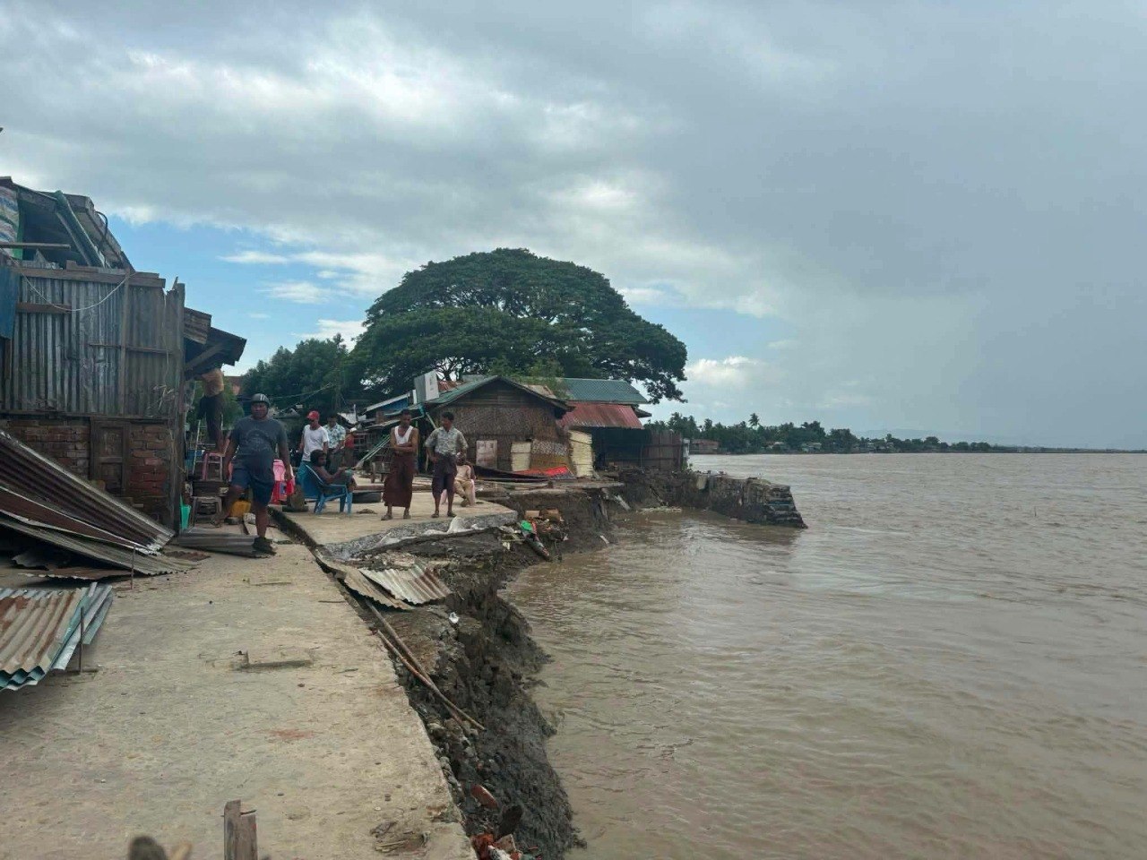
In Minbya Township, located 109 miles (175 km) north of Sittwe, rapid water level surges along the Laymyo River caused severe riverbank erosion, collapsing land and washing away 20 homes this month alone.
With critical logistics chains disrupted by both military blockades and natural disaster, humanitarian networks warn that disease outbreaks and acute food insecurity will escalate rapidly across resistance-controlled territory without immediate relief interventions.