


FROM THE DVB NEWSROOM
“Our village has plenty of water, but it’s becoming unusable,” said Win Htay, 45, a lifelong resident of Gawdu village, which is located in Ahmar town of Pyapon Township, Ayeyarwady Region.
She looked at the water around her. The hand-dug water springs in the monastery complex, which provided fresh water when she was young, have now been submerged under the sea.
“About 10 years ago, it was a long way from the main village to the shore. Now, the shore is just right next to us and we can’t find fresh water anywhere,” added Win Htay.
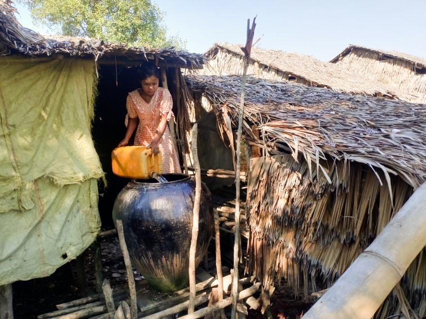
Due to the rising sea level, Gawdu village has shrunk in size. Freshwater wells have had saltwater intrusion. Residents have come to rely on rainwater.
Since October, residents have to purchase water from Thamein Palae village, located a 30-minute boat ride away.
“In years with less rainfall, we suffer even more,” said Myo Min Hlaing, a trader living in Gawdu village.
But even the water wells in Thamein Palae village have run dry. With its water supply depleted, the village is unable to sell fresh water to Gawdu residents anymore.
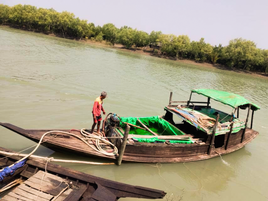
Now Gawdu residents must travel an additional 30 minutes by boat to A Shae Phyar village, to find fresh water to purchase. They used to pay only 1,500 kyat ($0.72 USD) for an 80-gallon bucket (302 liters).
But in A Shae Phyar Village, the cost is over 2,000 kyat ($0.95 USD). On average, families use approximately one 80-gallon bucket of water per day.
Win Htay and her husband have one daughter. The family earns an average of 300,000 kyat ($143 USD) per month. They spend about one-third of their income, roughly 100,000 kyat ($47 USD), on water each month.
Ahmar town, which consists of Gawdu, Thamein Palae, and A Shae Phyar villages, is located in Pyapon Township of Ayeyarwady Region. It sits at an elevation of 8.2 feet (2.4 meters) above sea level.
It is on the Gulf of Martaban at the southern edge of the Ayeyarwady delta, which extends into the Andaman sea. Pyapon and Bogale townships are tidal regions, where in some areas river water becomes saline and unfit for consumption.
These areas of Pyapon District, in Ayeyarwady Region, primarily depend on underground water and hand-dug pits to obtain fresh water.
Gawdu village is situated at the confluence of the Andaman Sea and the Bogale River. The village was established 80 years ago. It comprises 200 homes and a population of about 1,000 residents.
Myint, 70, is the same age as the village itself. She reminisces about 25 years ago when fresh water flowed from hand-dug wells in the monastery complex. During that time, villagers didn’t have to worry about finding and purchasing fresh water.
“We used to fetch water from the monastery using buckets and small pots. But now these water sources are underwater and no longer usable,” she said.
With the effects of climate change, water scarcity has worsened rapidly in recent months, making obtaining fresh water the most difficult part of life in Gawdu, added Myint.
Daunggyi Tan and Gayatgyi villages are neighboring Gawdu. But residents state that Gawdu village has been effected the most, as its hand-dug freshwater pits have completely submerged underwater.
Gawdu village residents lament the loss of freshwater sources like hand-dug pits. Despite efforts with artesian wells, only salt water is produced, making it even more difficult to find fresh water.
Htay Win said that the water residents purchase in Thamein Palae Village is drinkable during the rainy season but turns salty during the summer, making it unfit for consumption.
“It can lead to diarrhea in children. We keep glucose handy, knowing it’s not ideal, but we have no other option. We’re forced to make do,” added Win Htay.
Kyaw Oo, a researcher on water, attributes the rise in sea level, reduced river flow, declining rainfall, and increased groundwater extraction and consumption, to urbanization.
Water resource engineers predict that the infiltration of seawater into groundwater aquifers in the coastal areas of the Ayeyarwady delta in Myanmar will worsen in the coming years.
As global temperatures rise, the sea level, which has absorbed significant amounts of carbon dioxide, is steadily increasing due to melting glaciers. The World Meteorological Organization stated that the rate of sea level rise has doubled since 1993.
The World Wildlife Fund (WWF) report on Myanmar’s ‘Climate Vulnerability Assessment for Policymakers and Planners’ was published in 2017. It predicted that Myanmar would experience between five and 13 cm of sea level rise (from two to more than five inches) from 2020-29, and between 20 and 41 centimeters (from eight to nearly 1.5 feet) from 2050-59.
Previously unflooded coastal areas in Myanmar may become permanently inundated, leading to an increase in both the amount and frequency of flooding along the coast. Additionally, a sea level rise of 0.5 meters (19.68 inches) is estimated to cause the coastlines of low-lying areas in Myanmar, such as the Ayeyarwady River Delta, to recede by approximately 6.2 miles (10 kms).
“The sea level rise is very noticeable lately. Half of the village is now underwater. The area where we used to live, the western side of the village, is now submerged. It’s just water there now. The monasteries, the schools, all had to relocate. That area used to be very lively before. The site where we live now was once forested; we had to clear it to live here,” said Win Htay.
“As the sea level rises, residents constantly have to relocate, and some become homeless. The entire village is flooded during the rainy season,” she concluded.
Approximately 10 houses in Gawdu village have had to be relocated from their original locations. Those unable to relocate permanently must seek shelter elsewhere when the water rises, which happens three times per year according to residents.
Myaungmya, Ngapudaw, Mawgyun, Pyapon, Kyaiklat, and Dedaye townships, situated in Pathein Township of Ayeyarwady Region, are particularly affected by saltwater infiltration.
A third of the 100-acre village of Gawdu is already submerged underwater, and there’s a risk that more land will be lost to the sea in the coming years.
Gawdu village was impacted by Cyclone Nargis in 2008, which claimed nearly 100,000 lives in the Ayeyarwady delta. No casualties were reported in Gawdu, but residents said that almost all of their homes were destroyed in the cyclone.
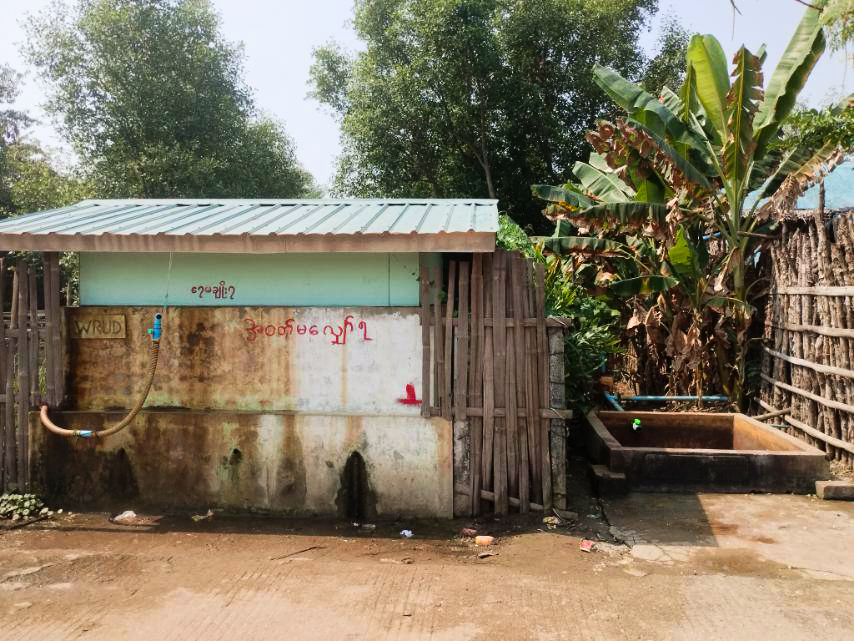
“After Nargis, a stone reservoir was donated to us. Initially, it served its purpose of storing rainwater, but now it’s in a state of disrepair, with water seeping through. We lack the expertise and funds needed for repairs. We can only imagine. Our financial situation doesn’t allow us to undertake the repairs ourselves.” added Myo Min Hlaing.
Kyaw Oo, the researcher, suggests strategies such as monitoring groundwater levels, reducing extraction during low levels, relocating extraction sites to higher areas away from saltwater zones, and constructing coastal reservoirs to control saltwater infiltration.
To accomplish this, officials must ensure that local users understand the nature of saltwater infiltration, and they themselves must demonstrate sincere dedication and careful execution.
