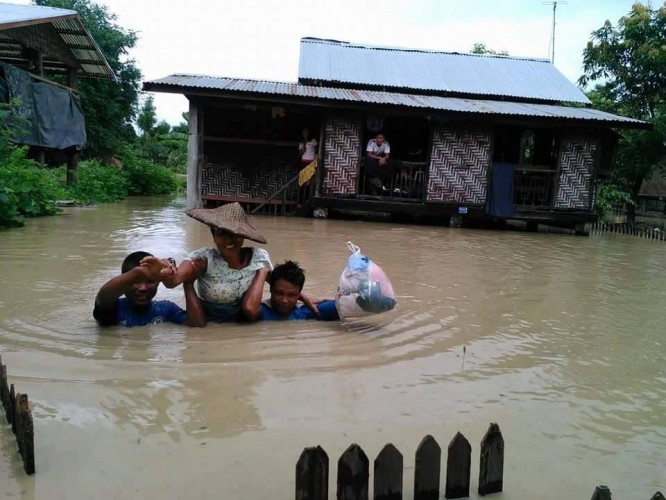
Many areas around Burma have been flooded, and severely affected by mud- and landslides.
Pedestrians in Rangoon are advised to tread carefully and watch out for those notorious potholes.
In Chin State and Sagaing Division, roads are mostly inaccessible, and several highland houses built on terraced hills have fallen as the land subsides underneath.
Magwe Division has been hit by heavy non-stop rainfall over the past four to five days. Some 80 villages and over 5,000 acres of farmland have been inundated, including the towns of Sidoktaya, Pwintbyu, Ngape, Saku and Minbu. Around 500 residents from the towns of Saku and Ngape have been evacuated.
The town of Kale, situated next to the Chindwin River between the Chin Hills and the Kabaw valley, is experiencing what one elderly resident claimed to be “the worst floods in 40 years”. Many local villagers there have been evacuated to safety.
[related]
A warning was issued in Kale at 7pm on Tuesday, informing residents living near the Razajo reservoir that the dam is nearing overflow as rains continue.
And in the Pegu Division town of Gyobingauk, over 3,000 acres of farmland and low-lying homes have been flooded.
Flood warnings are issued regularly by the Myanmar Department of Meteorology and Hydrology. See HERE
Read more: 16 dead as flooding strikes Sagaing, Mandalay, Shan


