


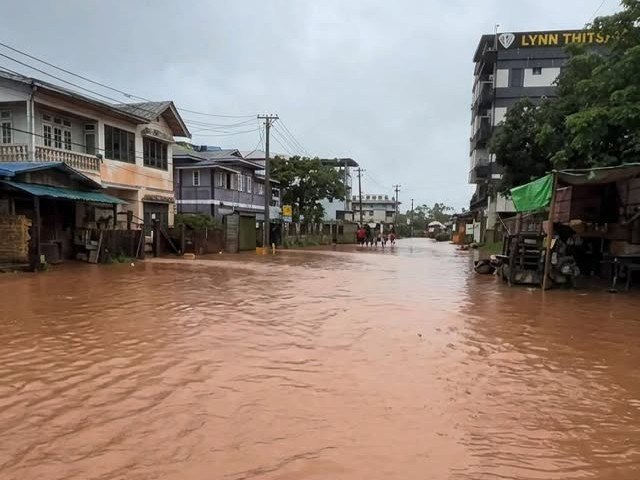
The regime’s Department of Meteorology and Hydrology (DMH) reported that the Shan State capital Taunggyi Township recorded its highest-ever amount of rainfall in 52 years on Wednesday, with 4.05 inches (103 mm) falling in a single day on Nov. 11.
Residents across southern Shan’s Taunggyi, as well as Aungban, Kalaw, Hopong, Nyaungshwe, Laihka and Kholam towns, located 13-106 miles (20-170 km) east and west of Taunggyi, have reported flooding and landslides due to continuous heavy rainfall since Nov. 8.
A Taunggyi resident told DVB on the condition of anonymity that debris from a rain-triggered landslide blocked the six-mile (9.7 km) road connecting central Taunggyi to Aythaya Vineyard on Nov. 10, while Kangyi and Pyidawtha wards were flooded on Nov. 9.
Two wards in Kalaw Township were flooded and landslides have blocked roads into the hill resort town on Nov. 10. No casualties have been reported in either town.
Thunderstorms and rain are expected in Naypyidaw, Mandalay, Magway and Sagaing regions, as well as Chin, Arakan, Karenni and Shan states from Nov. 11-12, according to the DMH.
At least four instances of flooding and landslides have occurred across southern Shan so far this year.
Four bodies belonging to a family in Monghsu Township were recovered after a landslide destroyed homes on Sept. 8. Monghsu is located 180 miles (300 km) northeast of Taunggyi.
SHAN News reported that over 3,000 acres of farmland in the “Pong Inn region,” located at the junction of Taunggyi, Hopong, and Hsihseng townships, were destroyed by floodwaters in March. Hsihseng is located 53 miles (85 km) south of Taunggyi.